SatCHAT
 TelePIX
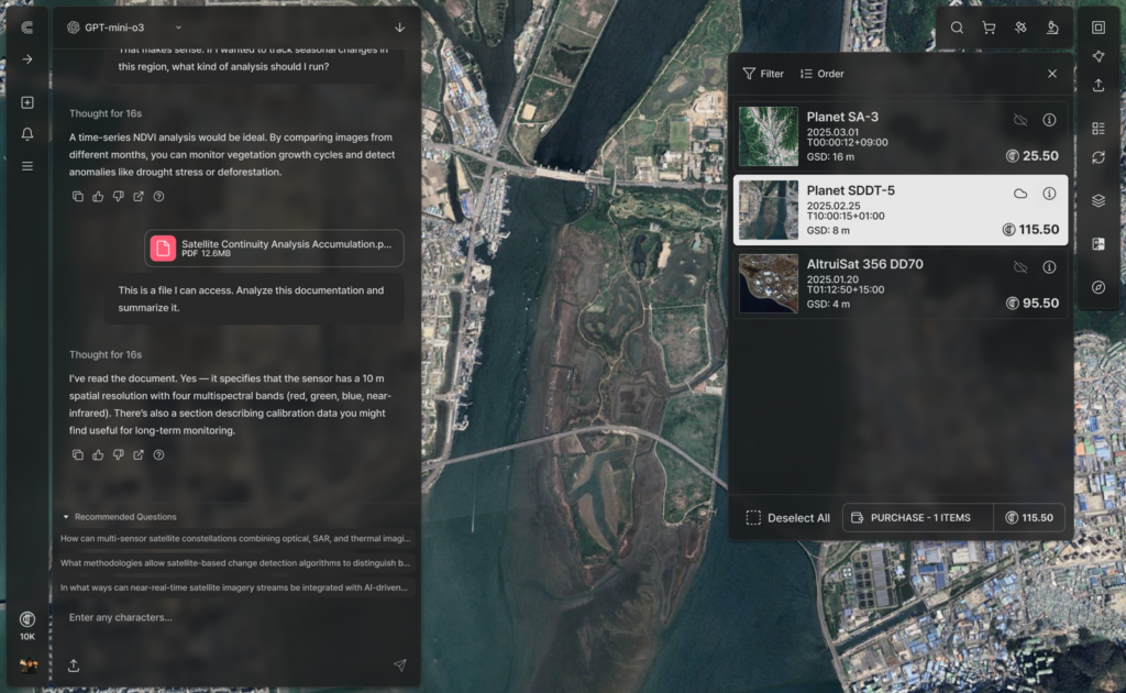
AI-driven geospatial intelligence platform enabling natural-language search and analysis of satellite imagery.
Technical specifications
- Interface
- Natural language query
- Imagery sources
- Optical and SAR
- Detection capability
- Sub-pixel detection
- Data fusion
- AIS/RF cross-referencing
- Applications
- Blue-carbon monitoring, land-use change detection, stockpile estimation, vessel detection
About
SatCHAT is TelePIX’s AI-driven geospatial intelligence platform that lets users search and analyze satellite imagery using natural language queries. It integrates both optical and SAR imagery with proprietary sub-pixel detection algorithms and can cross-reference AIS and RF signals for maritime monitoring use cases. Applications include blue-carbon monitoring, land-use change detection, commodity and stockpile estimation, and vessel detection, making advanced Earth observation analytics accessible without requiring specialized remote-sensing expertise.
Documentation
No public datasheet yet — request the datasheet / ICD from the supplier.