HEO Inspect 3.0
 HEO Robotics
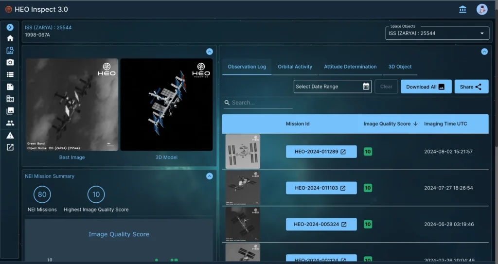
Web app and API gateway to HEO's non-Earth imaging catalogue, letting customers task satellites in real time and retrieve imagery and insights.
Technical specifications
- Core functions
- Explore, Task, Analyse
- Use cases
- Threat assessment; anomaly resolution and attribution; satellite commissioning; rendezvous and proximity operations
- Analytical capabilities
- Identification & characterisation; attitude estimation & tumble rate; 3D modelling; mensuration
- Access
- Web application and API
About
HEO Inspect 3.0 is HEO’s commercial gateway to non-Earth imaging (NEI) and insights. The platform lets customers explore HEO’s growing catalogue of resolved images of satellites and other resident space objects, task HEO’s global network of sensors in real time to capture new imagery on demand, and analyse the resulting data through a single web application and API.
The workflow is organised around three core functions: Explore, allowing users to browse and search HEO’s existing NEI imagery catalogue; Task, allowing users to request new imaging passes of specific objects from HEO’s sensor network; and Analyse, which surfaces derived insights from captured imagery.
HEO Inspect supports use cases including threat assessment, anomaly resolution and attribution, satellite commissioning support, and rendezvous and proximity operations monitoring. Analytical capabilities delivered through the platform include object identification and characterisation, attitude estimation and tumble-rate measurement, 3D modelling, and mensuration (precise dimensional measurement) of imaged objects.
HEO Inspect is built on the same underlying Tessera software suite that powers HEO’s sovereign and defence offerings, giving commercial customers access to operationally proven non-Earth imaging technology.
Documentation
No public datasheet yet — request the datasheet / ICD from the supplier.